
A Walk Around Cragg Vale and Coiners Country: Director Shane Meadows’ period drama The Gallows Pole is the TV version of the Walter Scott prize-winning novel of the same name, by Benjamin Myers. The story is based on real-life events of the 18th century and tells of ‘The Coiners – a band of counterfeiters based across Cragg Vale who clipped the edges of coins to melt down and forge currency. So prolific were these criminals that it is said they almost brought down the national economy and were brought to the attention of the king.
The filming of Gallows Pole took place in Cragg Vale in West Yorkshire and at sites across Nottinghamshire in 2021. If you watch closely you may even see Holdsworth House’s cupboard doors (that hang as decorative items on our restaurant walls) as part of the scenery. Shane Meadows stayed at Holdsworth House during filming and was so intrigued by our antique doors that he asked to borrow them for his set design.
Shane Meadows’ TV period drama stars Michael Socha as lead character David Hartley, and the stunning setting of Cragg Vale (close to Hebden Bridge and Mytholmroyd) makes perfect small-screen viewing. Visit the area to discover authentic weavers cottages, farmland and woodland, sweeping moorland views, hills and dales that are appealing to keen walkers.
There’s a fantastic hike created by cartographer and artist Chris Goddard. His Cragg Vale Coiners’ Walk map is hand illustrated and features extracts from The Gallows Pole book. It takes in many of the key locations in Myers’ story, including the house of King of the Coiners, David Hartley, atop of Bell House Moor. The walk really brings alive Myers’ vivid descriptions and, like the story itself, it isn’t for the faint-hearted.
 To begin, park in the centre of Mytholmroyd (on a test run of the walk, our team – including Roxy the wire-haired fox terrior – parked at St Michael’s Square car park HX7 5DS free for up to 4 hours). The walk takes you out of the town and into a stunning woodland setting that gradually climbs until it reaches Erringdon Moor and provides incredible views over the valleys and Mytholmroyd town before swooping down in to Cragg Vale and climbing high again to Stannary End. Here are our tips if you’re planning on doing the Cragg Vale Coiners Walk:
WALK SUITABILITY:
This is a long walk. The complete walk can easily take a full day if you stop to admire the incredible views and the points of interest linked to The Gallows Pole book. We mapped it a little longer than the 8.5 kilometres; more like 11-12k (but we did go slightly wrong and made a 2K detour).
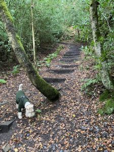 The walk is mostly off road and is particularly hilly. It takes in fabulous woodland, moorland and farmland. In parts it is boggy and slippery, so only suitable for able-bodied and keen walkers and sturdy walking boots are a must. The walk is brilliant for energetic dogs too, but watch out for grazing sheep, cattle and horses on the mid-section.
It’s predominantly uphill for the first third, until you reach Bell House Moor. Then it heads downhill to the valley of Cragg Vale before climbing steeply again to Stannary End and back down to Mytholmroyd.
The walk is mostly on public footpaths that have the Yorkshire Wildlife Trust, Stoodley Pike or Calderdale Metropolitan Borough Council footpath markers. So, if you’re ever unsure which way the map is sending you, look to see if any markers are visible nearby.
RECOMMENDATIONS:
Take a picnic for the top of the moor and plenty to drink since, once out of Mytholmroyd, the walk is quite remote.
We found the last third of the map trickier than the first largely due to fewer public footpath signposts. The final third of the walk was just as hilly as the first section. So, one option as you reach the Robin Hood Inn in Cragg Vale is to walk along the valley bottom (Cragg Road) back to Mytholmroyd (approx. 20 minutes). Or, once you reach the Lumb Stone at Bell House Moor, double back and return the way you’ve come – we found this the prettiest section of the whole walk.
WE LIKED:
- The rope swing hidden on your left as you walk up past Wriggles Bottom
- The ‘backwards bench’ in Spring Wood
- The refreshing lager shandy at the Robin Hood Inn, Cragg Vale
- The mint chocolate brownie at Jo’s Kitchen opposite the car park just over the bridge at Mytholmroyd
MAP TIPS:
From Erringdon Moor: At the top of Badger Bog, as you climb out of the woods to the open moorland (Erringdon Moor), take the path closest to the left, parallel to the drystone wall. The wooden signpost pointing to Bell House suggests taking a path a little further to the right. You know you’re on the right path when you see some walkways over boggy areas.
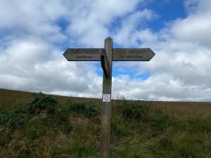
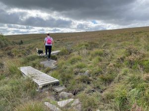
From Bell House: Not long after Bell House, you’ll come to a second house where the map tells you to turn right at ‘a heap of stones’. We couldn’t locate the heap of stones on our walk but at the second house a very faint path does in fact lead off to the right across the moor; look 45 degrees to the right and you’ll see it as it passes over the horizon.
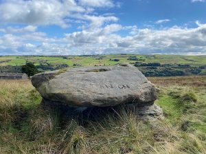 From Lumb Stone: After passing the Lumb Stone proceed, as the map says, down the most obvious path and through the field gate. The ‘top field’ actually sweeps down and round to the left. Climb over the stile and proceed straight down the hill on the faint path that hugs the right-hand wall. Pass the young plantation of trees on your right and keep heading straight down in the direction of the cottages (another path leads off to the left and is way-marked, ignore that). Go through the gate, across the field, through another gate and in between/past the cottages, then follow the footpath sign on the gate to your left. Essentially at this point you are heading down into the valley and the stream at the bottom. The footpath gets rather overgrown and narrow here but as you near the stream and Paper Mill Cottage, it does widen.
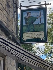 From Robin Hood Inn: If you’re continuing to follow the map from the Robin Hood Inn and not heading back to Mytholmroyd on the main road, you’ll find the path at Beech Cottages unmarked. Turn up the driveway in front of Beech Cottages to walk between the houses, turning right onto Twist Clough and then left (as the map says) behind the buildings at Upper Birks. Once you enter the woods, take the right-hand, gentle uphill fork through the trees. We made the mistake of taking an immediate right on entering the woods and followed the steep footpath that hugged the wall, and we went off track around 2 kilometres.
From Stannary End: At the top of the hill just after Stannary End, take the wide track that leads down the hill to the left through the holly trees. It will bring you out at the top of some farmland with a stone building on your left. Continue to your right (don’t bear left down the fields) and head straight forward – you’ll see a footpath marker not far in front. Soon you’ll see a wind turbine on your left between the trees. The path here isn’t well trodden, but you should spot a natural break in the hedgerow on the left soon that hides a stile leading to a cobbled footpath, which heads down to the left and eventually turns into Hall Bank Lane. Careful, the cobbles were slippery for us!

